The 1988 Magnitude 5.9 Saguenay earthquake
Location and Magnitude
- Local Date and Time: November 25, 1988 at 6:46:04 pm Eastern time
- UT Date and Time: 1988-11-25 23:46:04 UT
- Magnitude: MW 5.9; mb 5.9; mN 6.5; MS 5.8
- Maximum Intensity: Modified Mercalli VIII
- Latitude: 48.12° N
- Longitude: 71.18° W
- Depth: 28 km
- Preceded by a magnitude 4.7 foreshock on November 23, 1988, 4:11 am Eastern time
- Aftershock zone 35 km N-S by 35 km E-W
Interesting Features
On Friday November 25, 1988 the largest earthquake in eastern North America in 53 years occurred 35 km south of Chicoutimi, Québec and 75 km north of the Charlevoix-Kamouraska earthquake zone. This earthquake, referred to as the Saguenay earthquake, was located in a relatively aseismic region. It was characterized by a single foreshock, relatively minor aftershock activity, and a large amount of high frequency energy.
Intensities
The damage and felt reports are described in an Intensity Report of the Saguenay Earthquake
Strong Motion Records
The event was recorded by the GSC network of accelerograph stations. The maximum accelerations on rock were 0.156g horizontal and 0.102g vertical, recorded near Chicoutimi at epicentral distances of 64 km and 43 km, respectively. These strong motion records are described in the References and the digital data are also available on request.
Damage
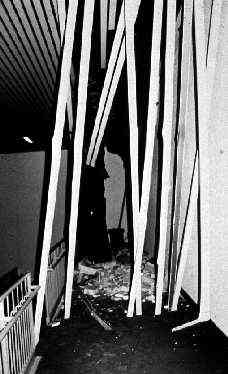
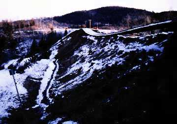
Despite the magnitude of the earthquake there was no loss of life attributed to the event and no structural damage was observed. The Saguenay event did point out the poor performance of unreinforced masonry in many structures and the susceptibility of embankments to stability failures.
Chicoutimi (about 40 km from the epicentre).
Damage to ceiling of Dominique Racine school, caused by falling masonry blocks from an unreinforced masonry wall.

Near Hervey Junction (about 170 km southeast of the epicentre)
A 100 metre section of the embankment failed, leaving the rails suspended. One other railway embankment failure, 6 highway embankment failures and several large natural slope landslides were attributed to the earthquake.

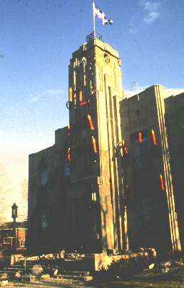
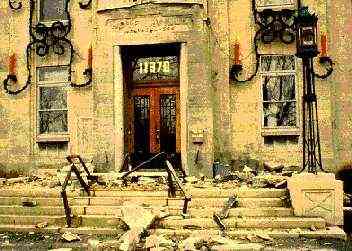
Montreal East: (about 350 km from the epicentre).
The former Montreal East City Hall suffered severe damage to the masonry cladding. Note that the structure is founded on 17 metres of clay and had suffered from excessive settlements prior to the earthquake


References
- Drysdale, J. and Cajka, M., 1989. Intensity Report of the November 25, 1988 Saguenay, Quebec Earthquake. GSC Open File Report #3279. https://doi.org/10.4095/207797.
- Lamontagne, M., 1991. Les tremblements de terre au Québec. Collection Environnement et Géologie, Volume 12, Bouchard, M.A., Bérard, J. et Delisle, C.E., eds. Association professionnelle des géologues et géophysiciens du Québec.
- Lamontagne, M. and Bruneau, M., 1993. Impact of Eastern Canadian Earthquakes of 1925, 1929, 1935, and 1944. Earthquake Engineering Research Institute (EERI) slide set. 27 slides, 35 mm.
- Mitchell, D., Tinawi, R. and Law, T., 1989. "The 1988 Saguenay Earthquake - A Site Visit Report.". GSC Open File Report #1999. https://doi.org/10.4095/130606.