
First observations of ground deformation resulting from Reno, Alberta earthquake sequence of November 29, 2022
When an earthquake occurs, it deforms the ground permanently. If the magnitude is large enough, and the rupture is close enough to the surface, careful comparison of before and after satellite imagery yields an estimate of the deformation. The latest Sentinel-1 data shows surface deformation resulting from the Alberta earthquake sequence. More information about the largest event in the sequence can be found here.
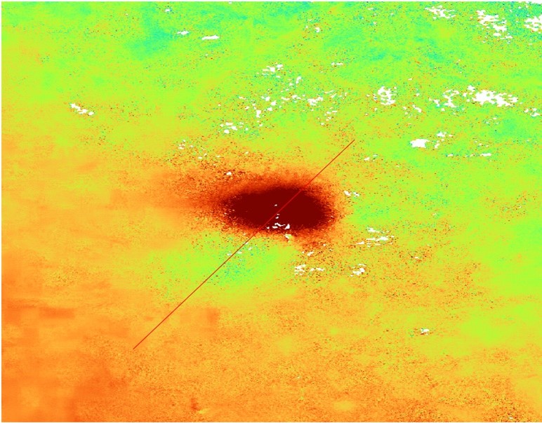
The figure above is an interferometric synthetic aperture radar (InSAR) image constructed from images captured on November 18 and 30, 2022. Click here for a map view of the interferogram. It shows the line-of-sight displacement between those two times, centered on the epicentre of the mainshock.
The figure below shows a profile of the measured displacements, along the red line in the figure above. The displacement axis is in meters, so the total displacement is approximately 4 cm.
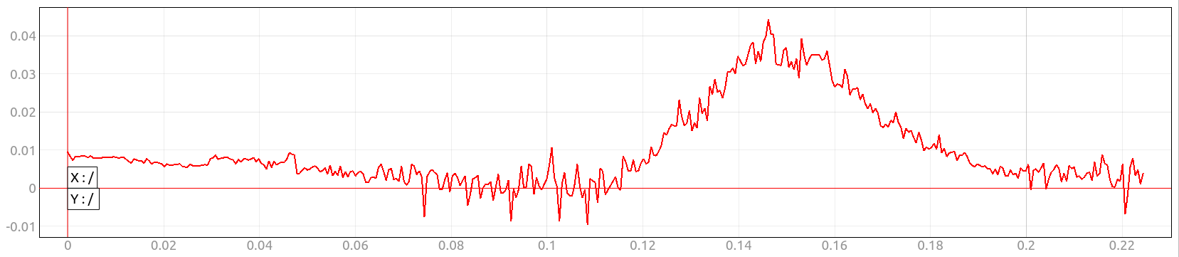
This information is important because it can help seismologists to understand the depth and focal mechanism of the earthquake.
Thanks to Sergey Samsonov, Canada Centre for Mapping and Earth Observation (CCMEO) and Natural Resources Canada (NRCan) for the imagery.