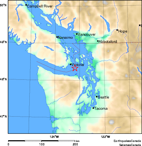
Earthquake Details (2010-02-20)
Saturday February 20, 2010
| Local Time: | 02:05:00 PST |
|---|---|
| Magnitude: | 2.9 ML |
| Latitude: | 48.33 North |
| Longitude: | 123.19 West |
| Depth: | 46.0 km |
| UT Date and Time: |
2010/02/20 10:05:00 UT |
Did you feel it?
Approximate Location of Earthquake: 17 km ESE of Victoria, BC; depth 46 km. 102 km S of Vancouver, BC. Lightly felt in greater Victoria, BC